user:Yangtze River Hydro-conservancy Committee date: 5th April, 2007
performed the survey in the building site of Qing River Shuibuya Hydropower Station
Project 1: two group
1.Focus: 50mm;
GSD: 26.24mm;
The photographic condition: 4 camera stations with 5 images taken at every camera station reelingly.
The sign boards’ (the reference points) distribution graph:
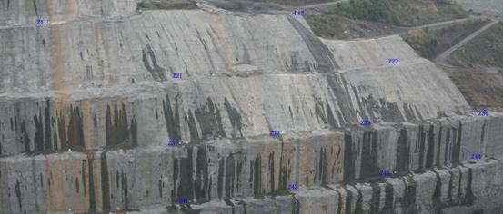
In addition: 4 sign boards were needed in principle (in the 4 corners); however some other sign boards were assigned as control points in order to increase the precision.
Outmatically creating:
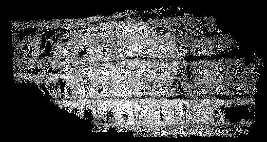
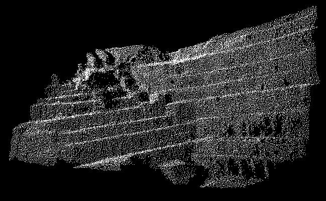
The image of point clouds:
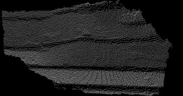
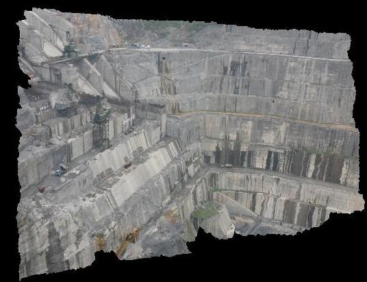
TIN landscape:

DEM-1(in the close-range depth direction):
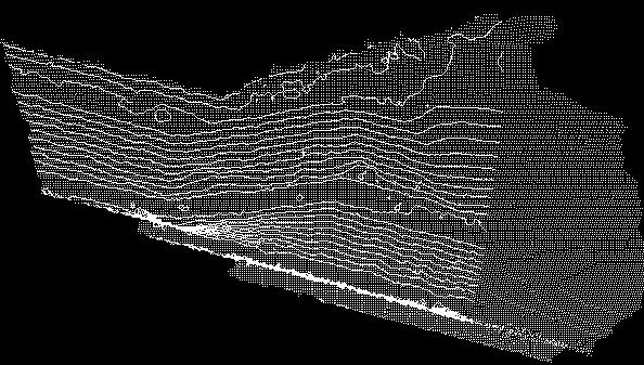
DEM-2(in the Z direction which displays the contours):
The report of precision:
The number of reference points |
The number of check points |
rms (m) |
Relative precision |
X(depth) |
Y |
Z |
precision of points |
4 |
8 |
0.0124 |
0.0151 |
0.0101 |
0.0220 |
1/7420 |
6 |
6 |
0.0119 |
0.0129 |
0.0112 |
0.0208 |
1/7684 |
2.Focus: 135mm;
GSD: 10.00mm.
The photographic condition: 3 camera stations with 5 images taken at every camera station reelingly.
In addition: due to the lower photographic distance (160m) and the longer focus (135mm), the view field angle was very small,so with the 135mm lens was only done in a small blocks area.
5mark points:
The number of reference points |
The number of check points |
rms (m) |
Relative precision |
X(depth) |
Y |
Z |
precision of points |
3 |
2 |
0.0107 |
0.0029 |
0.0024 |
0.0114 |
1/12962 |
Project 2:
3 photos were taken in all by using of the method of parallel photography, additionally the camera lens was 50mm, the camera type was Canon--EOS 5D, the image’s format was 35.8*23.9mm(4368*2912 pixels), the pixel’s size was 8μm and the photographic distance was about 500m( the reference points’ setting up, the relative orientation and the free network’s creation were not complemented at all).
Point clouds:
TIN landscape:
|